
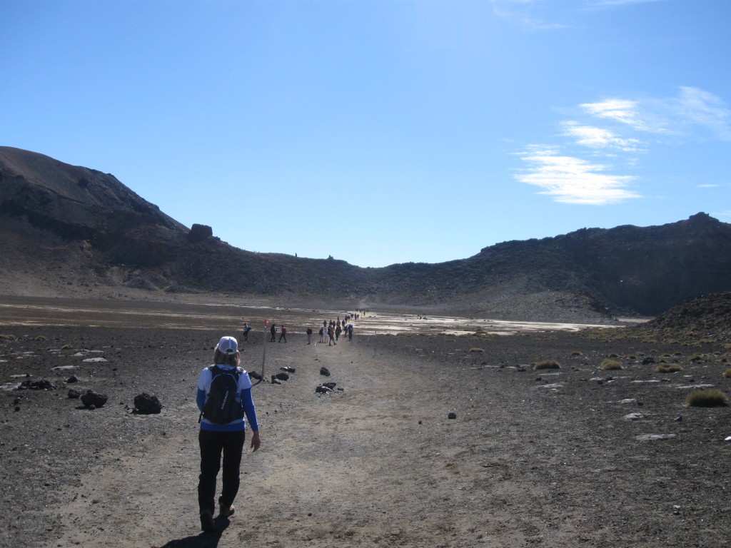
Arriving in National Park Village, which is located in the centre of the North Island, was my personal first highlight – I looked much forward to see the impressive, alien landscape the three (still active!) volcanoes formed in the Tongariro National Park, one of the places most worth visiting when travelling this particular part of NZ. This settlement lives almost purely from the tourists visiting the National Park, of which almost everybody is planning to do the famous Tongariro Alpine Crossing, a well-built hiking walkway over the alpine pass formed by Mt Ngauruhoe and Mt Tongariro. Of course this was our goal as well, so we arranged transport by the hostel we stayed at and went to bed early the day before.
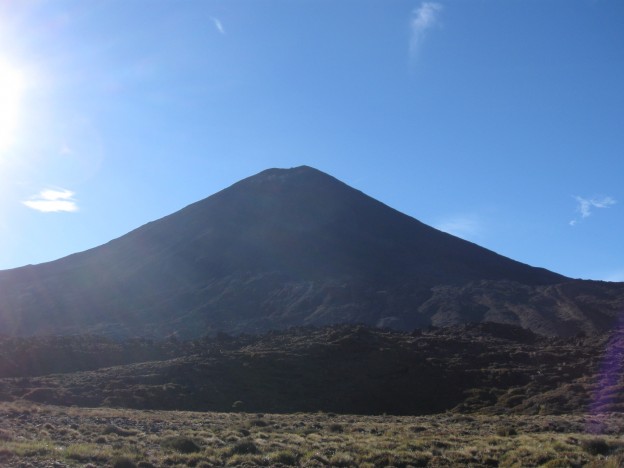
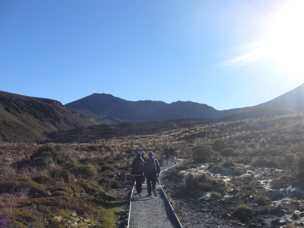
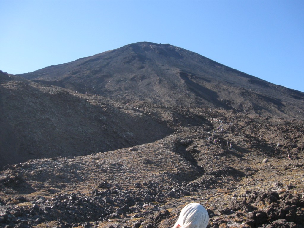
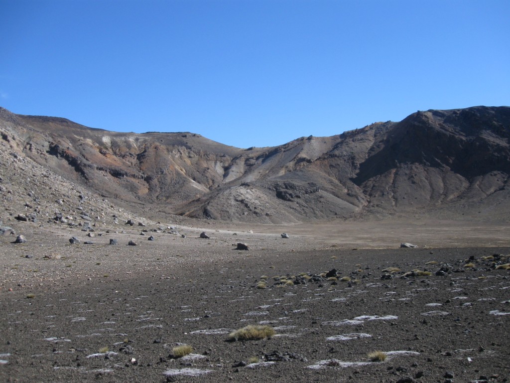
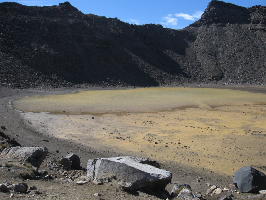
The Department of Conservation (abbr. DOC, NZ’s governmental department for the country’s environment and nature) estimated a time of six to eight hours for an average person to complete the trail; if you don’t climb the summit of the Ruapehu or Ngurahoe (both is optional to the crossing), you can even do it in less time, I made it in five hours, while I walked slowly in the downhill part after I finished the alpine part. You start on an ordinary way up, which develops into a zig-zag course with a seemingly endless number of stairs, until you reach the foot of the Ngauruhoe, which is known more commonly as “Mt Doom” as called in the Lord of the Rings movies. I was keen on climbing its summit to shake hands with Sauron personally, but unfortunately my knee didn’t like the idea due to his evil grandeur, and so I had to stop walking up after 20 minutes and return to the main route, as I likely wouldn’t be able to do the rest with experiencing pain with every step I take. Shortly after moving on, a huge valley opened in front of me and all the other people. Already now it doesn’t like the Earth we know anymore, but rather like another, lifeless planet somewhere out in space. On the right hand side of the walkway, a lonely yellowish/brownish “lake” turned up and announced the end of any “normal” landscape at all.
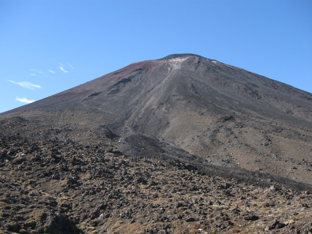
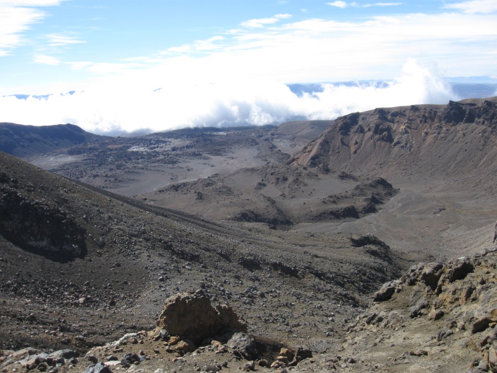
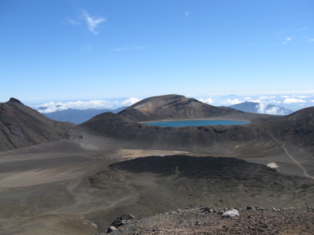
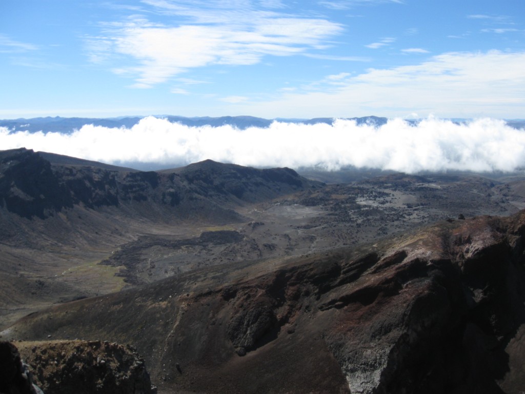
Going up further to leave the valley behind me, you get the first glance of what volcanoes can do in hundreds of years: Mars on Earth is the only thing which comes to mind when seeing these awkward, pale-brown rock formations. About 100 to 200 metres further lays the highest point of the trail, presenting a 360° degree view which you’ll never forget anymore: It starts with the Emerald Lakes in another valley and a bigger lake in front of you and goes on with the way to Mt Tongariro’s summit on your left and an even better view on the bizarre, yet impressive landscape on your right. I’ve met an American girl who actually camped (!) besides the big blue lake on top of the valley…not speaking about the fact that staying in this area is strictly forbidden and dangerous as fuck as the volcanoes can erupt at any time, last time happened in 2012 or even later if I remember correctly. Afterwards, back on your way down, you’ll see the hills and waters on the Northern border of the National Park, plus some steaming holes, which, if the volcano erupts, makes this part of the hiking trail impassable, as it gets immediately closed.
As you may have read I really enjoyed this trip, and despite the fact this walk is a big event and overcrowded with people (= which usually causes an attraction/place of interest getting worse and worse), it is worth every effort you put in it. Being formed by volcanoes makes this walk (almost? I don’t know about other continents) unique and it should be done by everyone coming to visit NZ for travel!